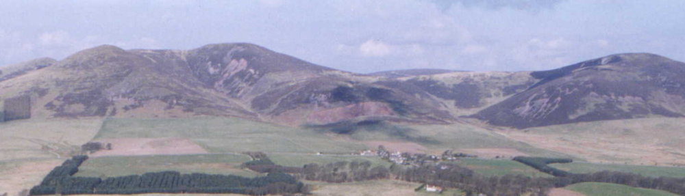
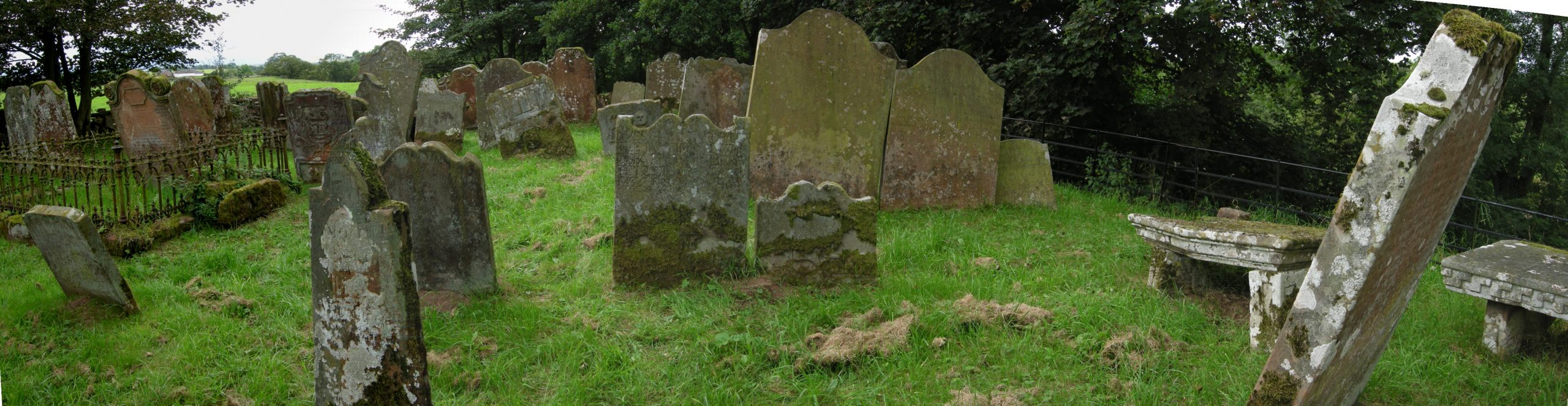
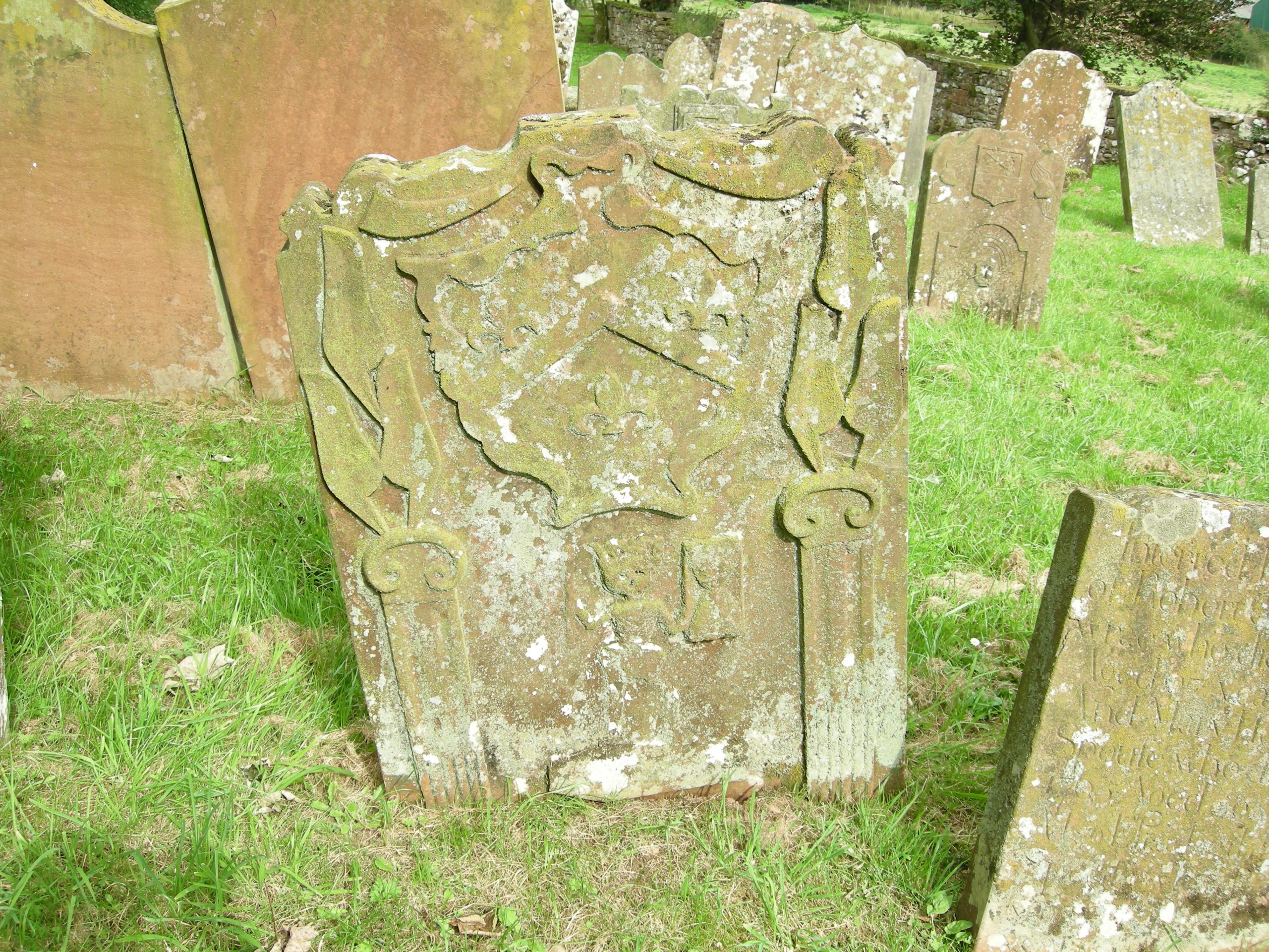
A short drive from Canonbie in Dumfriesshire, through quiet and pleasant farmland takes you to the ancient graveyard known as Half Morton or Tower of Sark. At the end of a grass track, the graveyard is surrounded by trees and sits on a high banking above the river Sark. The inscriptions on gravestones are nearly all two hundred or more years old. Scots poet and author George Mackay Brown described a kirkyard as “That strange peaceful book with stone pages that tells the history of a community”. If that is true then Harknesses played an important part in the history of this area – for three hundred years one of the most notorious, lawless and violent places in Europe – the Debatable Land.
How It All Began
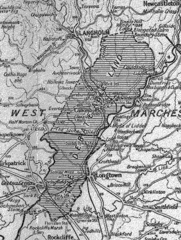
The Debatable Land was a narrow strip of land stretching north from the Solway about 4 miles wide and 12 miles long. Its history dates from the aftermath of Bannockburn –1314 – when scores were settled and rewards given for being on the winning side. Robert Bruce, King of Scots, declared John de Wake, an English nobleman’s Barony of Kirkandrews in Scotland forfeit and granted it to John de Soulis a Scottish supporter of Bruce. In 1320 Soulis was implicated in a conspiracy against Bruce and Kirkandrews was granted to Sir Archibald Douglas.
Wake was an English nobleman who owned property in Scotland. It was common at this time for both Scottish and English nobles to have property outside their own countries. The Treaty of Northampton in 1328 was drawn up as a peace treaty between Scotland and England. Amongst the lesser issues it was supposed to settle was the return of Kirkandrews to the Wake family. This did not happen and the Black Douglas’s held the land until 1431. However, failure to restore to Wake his Scottish lands planted the seeds of doubt as to the ownership and nationality of the strip of land on either side of the Scotland – England border that was to become known as the Debatable Land.
All of the land on both sides of the border between Scotland and England became a war zone from the Scottish wars of independence in 1296 until James VI of Scotland inherited the English Crown in 1603. For three hundred years living on either side of the border was to live constantly under the threat of war; raiding parties; the destruction of homes and crops; the theft of livestock; and general murder and mayhem. Nowhere was this worse than in and around the Debatable Land. At times living in this area was forbidden. “Border custom had settled down to an understanding that it should be treated as common pasture from sunrise to sunset by the neighbouring inhabitants of both countries. If a man built a house it could be burned with all in it and no penalty incurred; if there were persons within they could be taken prisoners – all this even during the day, since it was ‘stub and stake’, which was wholly forbidden. But if the men and goods were got out of the house in the daylight, only the house itself and what was within was forfeit; the house to be burnt and the goods taken. Should any one of either realm attempt: to carry away any of the said houses (which were thus mere temporary shelters or shielings), ‘or any wodde, gres or corne growing upon the said Debatable grounde, lyeng upon wanes, carts or horse bakkis’, then such goods which were being so conveyed would be forfeited to whosoever should arrest them. But if, before seizure they had been removed from cart or horse, forfeiture was not permissible”.
The Debatable Land became a place of refuge for lawbreakers and outcasts. Because no one knew for certain who was responsible for maintaining law and order there was none. In 1551 a determination to resolve the matter was made. The Wardens on both sides issued a proclamation “That all Englishmen and Scottish men shall be free to rob, burn, spoil, slay, murder and destroy all and every such person or persons, their bodies, buildings, goods and cattle as do remain or shall inhabit upon any part of the said Debatable Land, without any redress to be made for the same”.
The End
However the following year a more sensible solution was struck. Each country appointed two commissioners, one of the Scottish commissioners being Sir James Douglas of Drumlanrig. The French Ambassador acted as mediator. On 24th September 1552 formal agreement was reached and the Border between Scotland and England established as it remains to this day. Basically Kirkandrews went to England and Cannonbie and the Parish of Half Morton to the Scots. A line was drawn from the River Esk westwards to the River Sark just south of Crowesknowe Farm. This part of the Border was marked by a ditch and is still known as ‘Scots Dike’. Stones were raised at either end with the arms of Scotland and England carved on them.
The Harkness Connection
The gravestones in Tower of Sark link the name Harkness to this area.
“George Harkness in Crowsknowe who departed this life July 22nd 1765 aged 63 years…also James Harkness son to the above who died at Goldieslee April 2nd 1811 aged 76 years ….”.
“Edward Harkness in Bogra who died March 1760 aged 46 years…”.
“James Harkness of Barngleish – March who died 20th August 1838 aged 72 years …..”.
“Janet Armstrong spouse to William Harknas in Loganhouse who deperted this life 17th December 1751 aged 56 years also Thomas Herknes his son who died May 6th 1746 aged 40 years also James Herknes his son who died June 24th 1728 aged 19 years also Esther Herknes his daughter who died June 1st 1751 aged 42 years”.
“John Harkness in Goldieslee who died 30th November 1819 aged 47 years …”.
Also recorded are Harkness women – Scotswomen kept their maiden names throughout their lives – married to local farmers in places such as Parkhead, Greenwrae and Becknowes, all close by.
All of these places are in or near what was known as the Debatable Land.
Harkness Rigg
The only place in Scotland still known by the name Harkness – Harkness Rigg – is situated in what was the Debatable Land. (OS grid reference NY 3403 7692). It is now part of Beckhall Farm and the old farmhouse, probably dating from only the 19th century, was recently pulled down because it was in an unsafe condition. It is now shown on the latest Ordnance Survey maps as ‘Hawksnestrig’ but the local farmer at Beckhall, Tom Coates, has never known it called anything other than Harkness Rigg.
In the 1881 Census the place was recorded as “Harkness Rigg or Hackshall”. In the 1871 as “Hacknessrig” and in the 1851 as “Hawkshall”. There were no residents called Harkness in any of the Census.
Rig or Rigg is common in Scottish place names. It can mean a long narrow hill or a strip of farmland.
The name would almost certainly have derived from the fact that this farm or rigg’s inhabitants at one time were called Harkness. There are numerous examples of town and farm names in the area whose origins would have been similarly derived from one-time occupants – Kennedy’s Corner; Bellstown; Carrutherstown; Grahamshill; Browns Holm.
Conclusion
The precise history of the link between those of the Harkness name and the Debatable Land may never be known. The settlement of 1552 would appear to have given control of the Scottish section to Douglas of Drumlanrig. Nearly all the farms in the area today are owned by Buccleuch Estates, administered from Drumlanrig Castle. It is speculation as to whether the Harknesses were given rent of the farms in the Debatable Land because they were already resident in the area or because of a Douglas connection – perhaps a combination of both.