The Quest to Find The Hardkneys Farm
The Surnames of Scotland by George Black contains the following entry:-
“HARKNESS.
Harrison explains this name as “dweller at the Temple-Headland” (from OE. h(e)arg + ness), a place name unknown to the author.”
The question was – where is this temple-headland? The obvious place to look was in the area of the Pentland Hills where the earliest record of the name occurred.
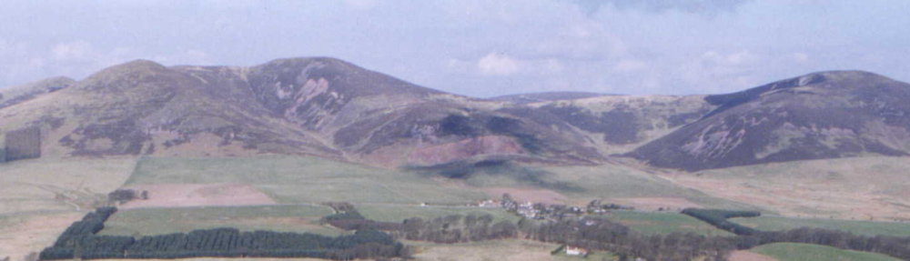
Sometime ago I came across a reference in The Statistical Account for Penicuik, 1791-99 which described an ancient camp in the parish and stated there was a similar encampment at the side of the Harkinburn within the woods of Penicuik. A 19th century local historian, J. Wilson, recorded a circular formation near the ‘Harkenburn’. The Harken Burn is shown on the 1st edition of the Ordnance Survey map of 1854 but is no longer shown on current maps and is now known as the Cornton Burn, and the farm close by as Cornton. There is today no local knowledge of the Cornton Burn ever having been known as the Harken Burn but there is a field next to the burn which is still known as the Harkenburn Field. Nearby Cornbank Farm was formerly known as Cairnbank.
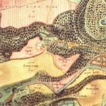
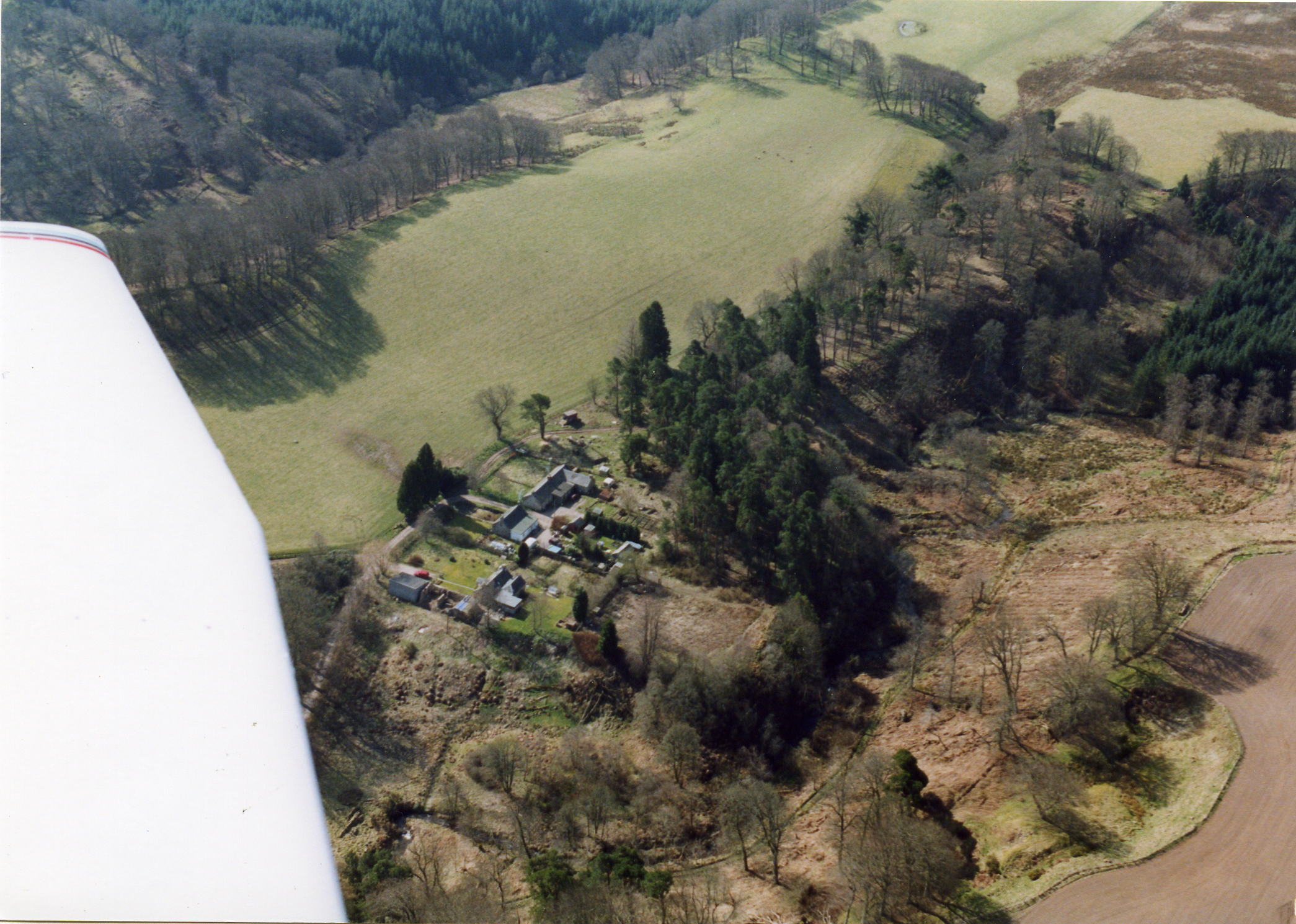
After further research I found two maps of Penicuik Estate dated 1796 by John Ainslie who showed the same burn as ‘Hardins Burn’ on one map and ‘Harking Burn’ on the other with the same circular formation shown nearby on both. Both names appear in Penicuik Estate records. The ‘circular formation’ lies on an elevated promontory between the Cornton Burn and the North Esk River.
The site certainly seems to conform to the second element of the name i.e., ness. Although the site is not very high, it is situated on a very well defined promontory formed by the steep, approximately 100 foot high, banks on both the river North Esk and the Harkenburn, immediately above where they join. I know the Pentland Hills area quite well and know of no other site which fits the description of a promontory so well. Margaret Gelling’s ‘Place Names in the Landscape’ gives examples of ness which seem to describe the location quite accurately. The actual site where the ‘circular formation’ was shown is on a small, further elevated and clearly defined portion of the promontory, but is still not of any great height.
Interestingly, Gelling in describing Harrowden, Bedfordshire states,
A compound of hearg and dun ‘hill’. ———-The hill is a low one, formed by the 100 ft. contour which here projects into low ground by the two rivers.
And for Harrowden, Northamptonshire,
—- occupies a small hill between two stream valleys ——– .
David Wilson in ‘Anglo-Saxon Paganism’ has,
—- although they are normally within striking distance of pre-historic or Roman routeways, the majority seem to have no very close geographic relationship to them; they are close enough to the routeways to have been the main means of approach, but not for the hearg to have been immediately accessible from such routeways‘
There is a Roman road just under a mile from the site.
No metal objects were found and although a few ditches were dug on various places across and around the site over the five years, there has been surprisingly little found. I think it is significant that apparently no domestic related finds or debris were found.
Because of the foregoing, it is not possible to say conclusively that the site is a ritual or ceremonial site. However, I believe that taken together, the place-name evidence; the topographical evidence; and the archaeological evidence, such as it is, suggests the possibility that this may have been a hearg site and that it is very likely that the present farm of Cornton was the original site of Thomas de Hardkneys farm.
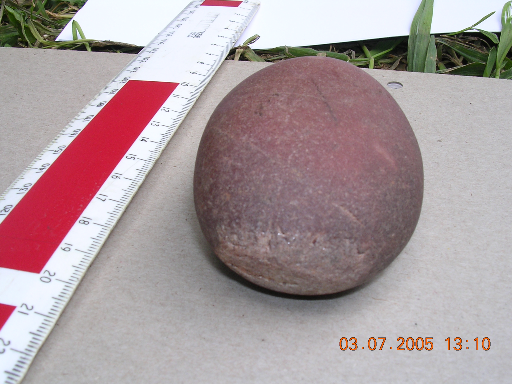
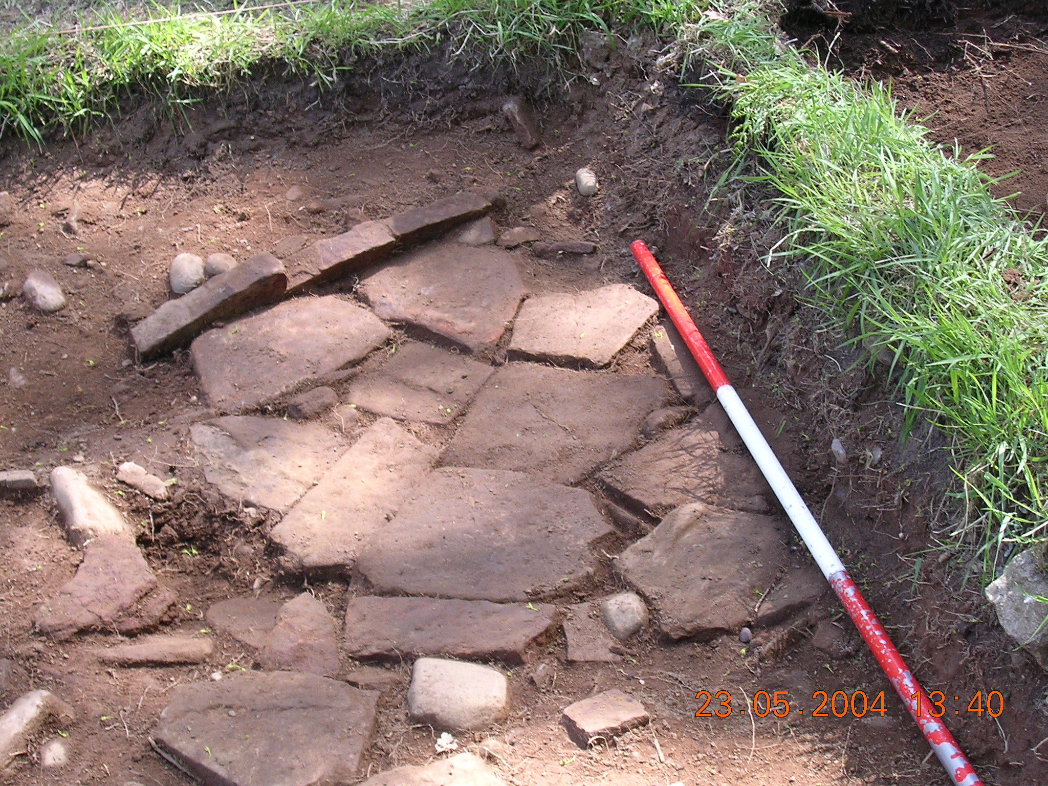
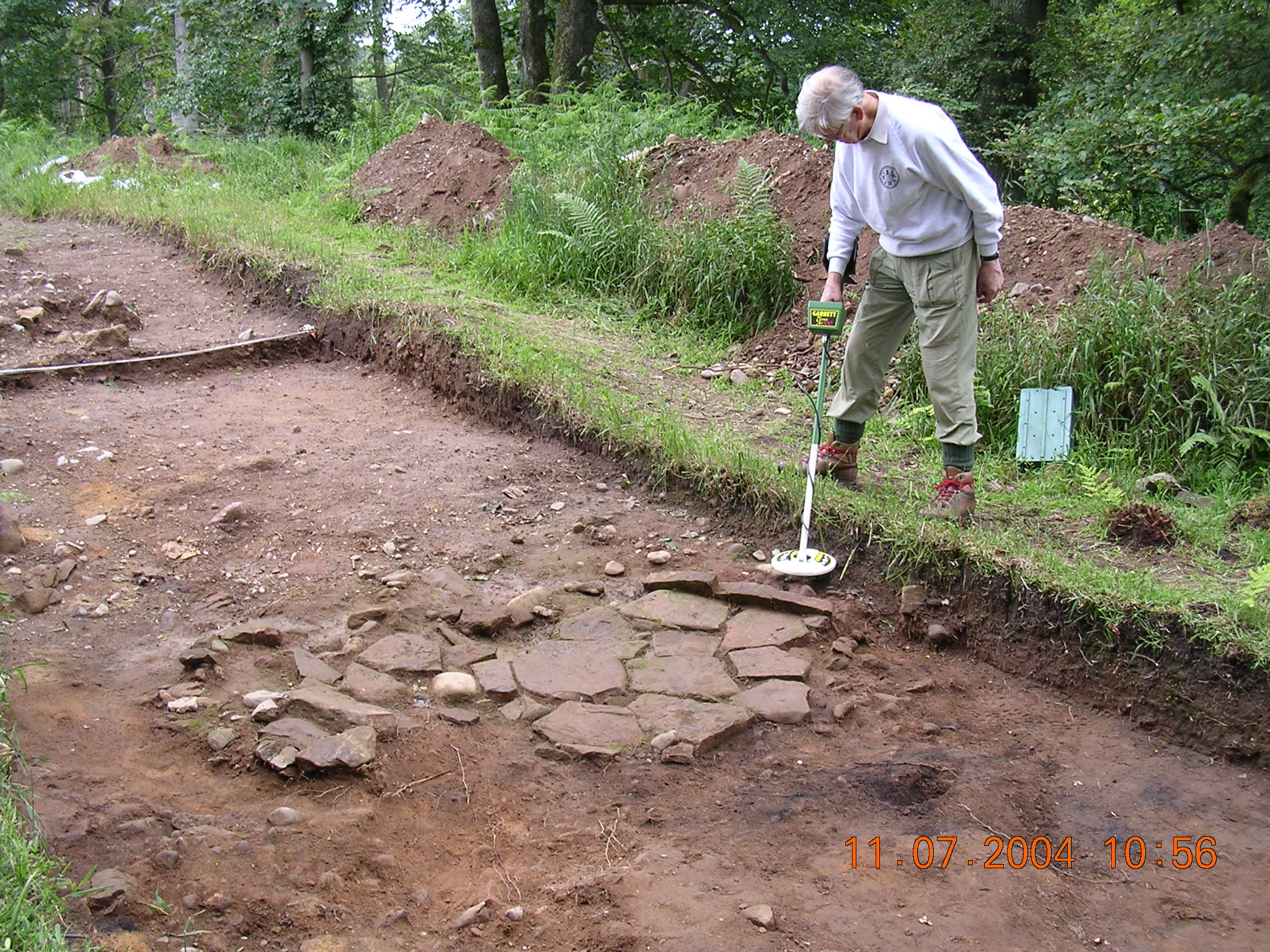
Briefly, in 2002 I interested the Edinburgh Archaeological Field Society – a voluntary organisation – in the site. Excavations and a survey of the site were carried out over a period of five years, although each year access to the site was restricted to a fairly short season of about four months to allow the local gamekeeper to use the area for raising pheasants. There was little left of the actual circle, probably due to robbing of the stones for agricultural purposes. During excavation a number of separate areas of flat stones were uncovered, carefully placed to form what some considered to be hearths. Under these were found signs of what have been described as cremations with fragments of bone which have not been analysed. There were also two small hand grinding stones with a resinous type substance found in the grinding surface. Unfortunately, EAFS is a voluntary organisation with limited resources. Consequently analysis of the finds has not revealed as much as it might have. A date of around 300BC has been put on some of the material found.